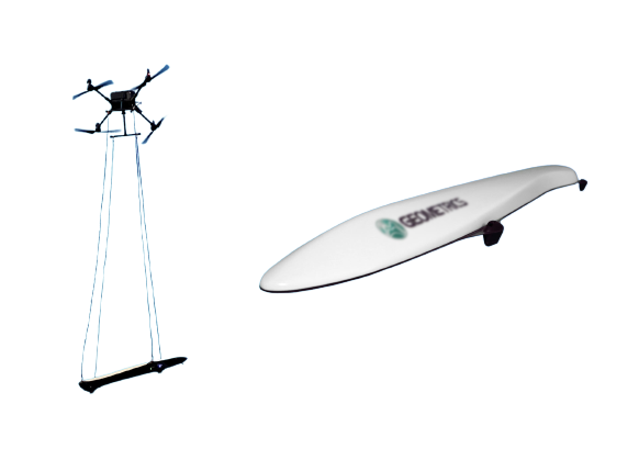
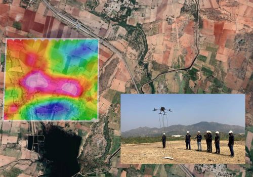
Drone-based magnetometers expedite mineral prospecting, saving time and costs for clients. High-speed, precise surveys pinpoint deposits efficiently, reducing exploration expenses.
Know More
Operating Principle
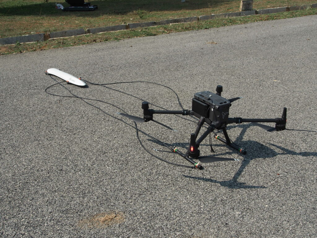
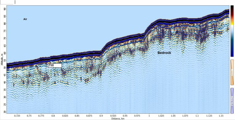
Laser pumped cesium vapor (Cs-133 non-radioactive) total field scalar magnetometer.
Depth
Curie Depth (770°C)
Operating Range
20,000 to 100,000 nT
Operating Zones
Configured for operation anywhere in the world without dead zones.
Sample Rate
1000 Hz sample per sec
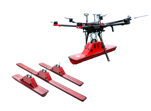
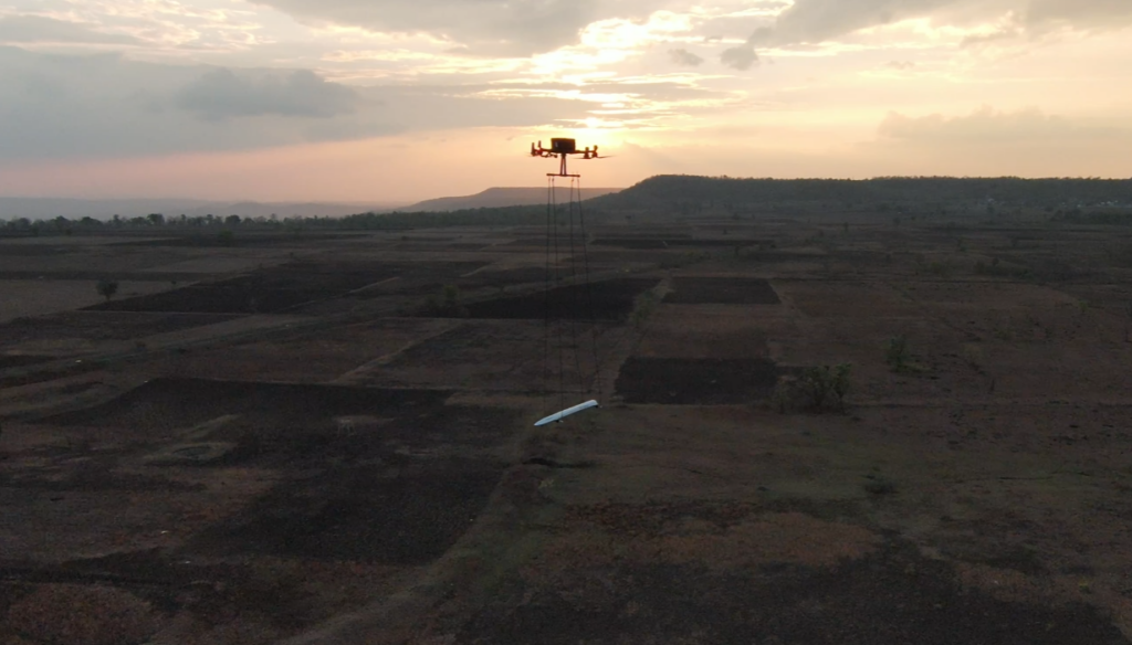
DRONE BASED GROUND PENETRATING RADAR
Drone-based Ground Penetrating Radar (GPR) deploys radar waves from drones to explore subsurface structures. It's useful in various fields like Tailing Dam, construction, archaeology, and infrastructure inspection, & Shallow depth Geological structures. allowing for non-destructive subsurface assessment.
Know More
Operating Principle
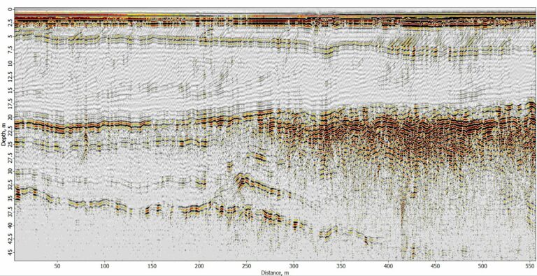
High-frequency (32 Mhz) electromagnetic pulses into the ground, measuring the dielectric properties of subsurface materials
Depth
120m
Operating Range
1600 ns
Operating Zones
Configured for operation anywhere in the world without dead zones.
Sample Rate
3.125 samples per nano sec
Your Area, Our Expertise - Connect for Exploration
Advantages of Drone Based Geophysical Survey with Magarrow & GPR
Time-efficient
Acquire data faster compared to traditional methods.
Accessibility
Drone magnetometers provide detailed magnetic data, pinpointing minerals in inaccessible areas.
FastTrack 10X
Projects which takes 3-4 years can be completed in 5-6 months with great efficiency and accuracy.
Prospect Vs Reject
Directly reach the drilling targets by reducing 60-70% (Prospect Vs Reject) of drilling efforts.
Safety
Drones reduce human risk by exploring hazardous terrains, enhancing safety.
Land Acquisition
Drone magnetometers assess land, identify features, and reduce risks in acquisition.
Automated flight
Fully autonomous flight with follow the terrain advantage.
Multi-Sensor Advantage
Drones integrate various sensors for comprehensive geological data.
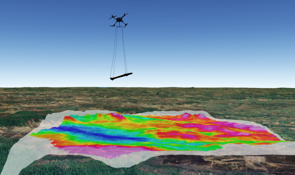
Subsurface Models
High-res drone data contributes to accurate geological models.
Potential applications of Drone-based Magnetometers
Critical Mineral Exploration
Drone-based magnetometers are valuable for critical mineral exploration. They detect magnetic anomalies caused by mineral deposits, aiding remote sensing. Target minerals include:
Drone-based magnetometers excel in mineral exploration, swiftly detecting magnetic field anomalies with 10x speed and precision. This slashes drilling efforts by 40-60%, reducing costs significantly. They also excel in identifying deeper mineral deposits, ensuring efficient and economically viable exploration.
Where minerals meet innovation - your exploration begins today - Contact Us
Oil and gas exploration
Elevate oil and gas exploration with our state-of-the-art drone magnetometer tech. Detects subsurface anomalies for precise drilling site data.
UXO Detection
Unexploded ordnance (UXO) can pose a significant threat to public safety and the environment. Our drone-based magnetometer technology provides a safer, faster, and more efficient way to detect and dispose of UXO, saving lives and reducing environmental damage.
Potential applications of GPR - Ground Penetrating Radar
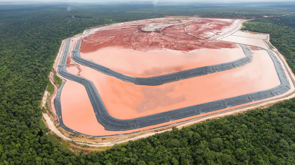
Inspection of Tailing dams in mines (Strength & Leakage analysis)
Our state-of-the-art drone-based Ground Penetrating Radar (GPR) technology enables comprehensive tailing dam inspections, utilizing high-frequency electromagnetic waves to penetrate and map subsurface layers. Integration of drone-based GPR systems with AI & Ml technology detects potential issues such as leaks, voids, and erosion, providing detailed data to prevent dam failures and environmental disasters.
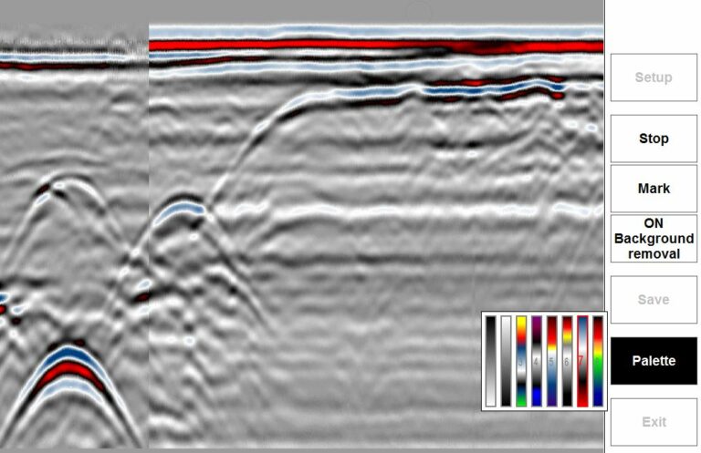
Lithological Characterization and Stratigraphic Modeling
The potential applications of drone-mounted Ground Penetrating Radar (GPR) technology in performing lithological characterization and stratigraphic modeling. It involves collecting subsurface geophysical data through GPR scans, which can then be interpreted to create models that help understand the geological structure and properties of the area of interest.
Cavity – land/underground monitoring
With high-frequency electromagnetic waves, our drone-based GPR system detects soil cavities, sinkholes, and other anomalies for precise data collection.
Groundwater exploration
A fast, cost-effective, and environmentally friendly way to explore potential groundwater resources. Equipped with advanced drone-based magnetometers, identifying potential sites for groundwater exploration. With traditional exploration methods being time-consuming and expensive, our technology allows us to survey large areas of land quickly, saving you both time and money.
Archeological Findings
Our drone-based GPR service is a valuable tool for archaeological findings. By integrating GPR technology with drone-based surveys, we can accurately detect subsurface features, such as buried water resources and archaeological artifacts, using non-destructive methods. Our experienced team uses advanced processing and interpretation techniques to provide clients with accurate and reliable data for informed decision-making.
The Future of Mining Is Now: AI & ML for Smarter, Safer, and More Sustainable Operations.